
TLDR
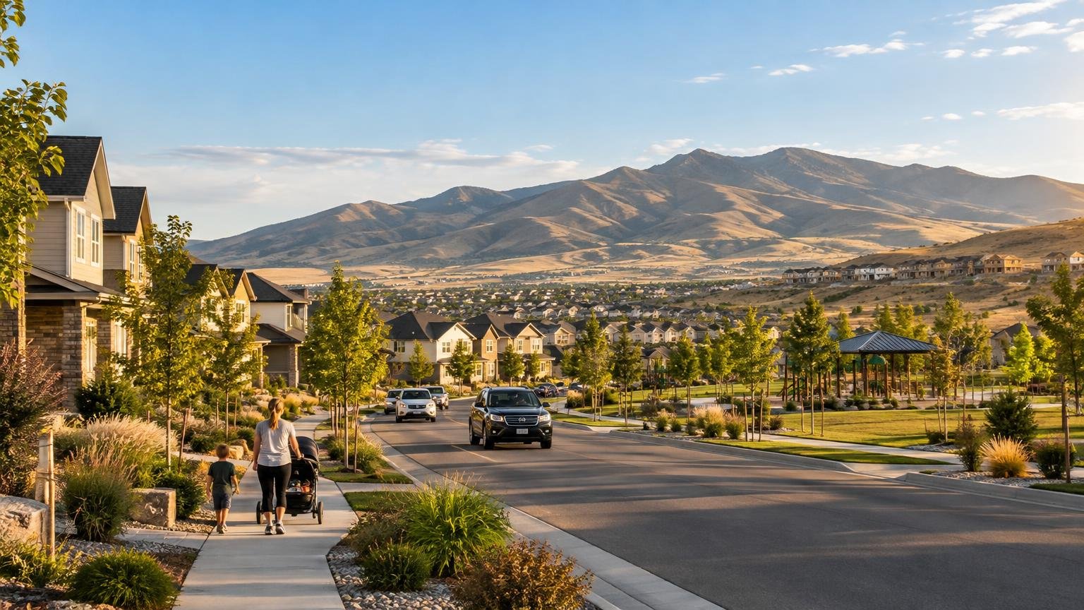
Herriman is a rapidly growing, primarily residential city at the southwestern edge of Salt Lake County. Its defining combination is newer development, large households, foothill geography, and infrastructure that is still adapting to growth. It feels suburban rather than rural, but its position against the Oquirrh Mountains gives parts of the city a stronger edge-of-the-valley character than many communities farther north or east.
For anyone asking what is Herriman Utah like, the practical answer is that it is a city in transition. Residents gain access to newer neighborhoods and a landscape shaped by foothills and nearby Butterfield Canyon, while also dealing with evolving roads, services, commercial areas, and regional travel patterns. The exact experience depends heavily on the neighborhood and commute.
Herriman is no longer a small foothill town
Herriman’s roots reach back to the agricultural settlement of Butterfield, established in 1851 near present-day Butterfield Canyon. The community incorporated as a town in 1999 while agricultural land was under increasing pressure for residential development, according to the city’s adopted General Plan.
The scale of the change is clear in the population record. The General Plan reports 1,523 residents in 2000 and 21,785 in 2010. The 2020 Census counted 55,144 people, and the Census Bureau estimated 63,282 residents as of July 1, 2025. The latest figure is an estimate rather than a new decennial count, but it still shows how quickly Herriman has changed within a generation.
Readers can review the dated demographic figures directly through U.S. Census Bureau QuickFacts for Herriman. The numbers matter because they explain much of what people notice on the ground: expanding residential districts, changing road connections, growing demand for public facilities, and a city identity that is still taking shape.
Calling Herriman a former farming community is historically accurate, but using that description alone would be misleading today. Agricultural origins remain part of its story and place names, yet most newcomers encounter a modern Salt Lake County suburb with active development rather than an isolated rural town.
What is Herriman, Utah like geographically?
Herriman sits in the southwestern Salt Lake Valley, with the Oquirrh Mountains to the west and the Traverse Mountains to the south. That position is more than scenery. It places the city near the physical edge of the developed valley, where residential streets, open ground, slopes, and canyon approaches meet. Herriman’s General Plan consequently treats open space, conservation, resource stewardship, and community character as important planning concerns.
The foothill setting can make two parts of Herriman feel meaningfully different. A neighborhood closer to major commercial roads may feel like a conventional suburb, while an area nearer the western or southern slopes may feel more visually connected to open terrain. Elevation, road layout, distance from everyday services, and the route out of a neighborhood can all affect the experience.
This location also distinguishes Herriman from growth corridors organized around the central interstate or an established rail station. Regional connections still matter, but residents should evaluate them from their actual address rather than assuming every southwest-valley trip works the same way. For broader context on how geography and development interact elsewhere along the Wasatch Front, compare Herriman with the Lehi–Draper Point of the Mountain corridor.
What daily life looks like
Herriman’s demographics point to a community with many children and relatively large households. Census data for 2020–2024 says 34.6% of residents were under 18, the average household contained 3.38 people, and 17,559 households were recorded. Owner occupancy was 78.6%. Those figures describe the city as a whole; they do not guarantee that every subdivision or street has the same character.
In practical terms, households comparing Herriman neighborhoods should pay attention to the small geography of daily life. A home may be inside the same city as a park, school, shop, or arterial road but still require a longer drive than expected because of subdivision design, terrain, or incomplete street connections. Looking at a citywide map is not enough.
The Census Bureau reports a mean travel time to work of 27.1 minutes for workers age 16 and older during 2020–2024. That is a broad statistical average, not a promise about any particular commute. Direction, departure time, road projects, weather, and the location of an employer can produce a very different result.
Anyone moving for work should test the trip at the time it would actually be made. A drive toward an office elsewhere in Salt Lake County raises different questions from one toward Utah County or a nearby southwest-valley workplace. Public transit should likewise be checked by exact address and schedule rather than inferred from regional service elsewhere. Readers considering wider Wasatch Front travel can also see how FrontRunner influences commuting and development, while remembering that access to regional rail depends on reaching a station.
Growth is the main tradeoff
Herriman’s growth is not simply background context. It influences road planning, water management, public safety, parks, and traffic around schools. The city says roughly 14,000 additional homes are entitled, with most expected to be multifamily housing. An entitlement permits development under approved conditions; it does not mean every unit will be built immediately or on a guaranteed schedule.
That distinction is important for prospective residents. A vacant or partially developed area near a home may not remain unchanged, but an approved plan also does not reveal exactly when construction, roads, shops, or public facilities will arrive. The useful questions are parcel-specific: What has been approved nearby? Which improvements are funded? What is only conceptual? What construction access might affect the street?
Transportation plans are similarly time-sensitive. In an August 4, 2026 update, UDOT said it was designing a Mountain View Corridor freeway segment between Porter Rockwell Boulevard in Herriman and Old Bingham Highway in West Jordan. Construction was expected to begin in 2027, but UDOT explicitly noted that schedules could change. Check the current UDOT Mountain View Corridor update before relying on that timeline or planning a route.
The upside of a developing city is that its street network, amenities, and public spaces can continue to expand. The downside is uncertainty: construction, detours, school-area traffic, and changing surroundings may be part of normal life. Whether that feels energizing or frustrating depends on how much predictability a household wants.
How Herriman differs from nearby communities
Herriman is often grouped with Riverton, South Jordan, and Bluffdale because all are part of the broader southwest Salt Lake Valley. The most responsible distinction is not that one is universally better. It is that Herriman combines an edge-of-valley foothill position with a particularly visible stage of residential growth.
South Jordan and Riverton extend farther into the developed valley, while Herriman reaches toward the Oquirrh foothills and the Traverse Mountains. Bluffdale also occupies the southern end of Salt Lake County, but municipal boundaries, road connections, and development patterns create different daily routes. A regional map can make these places look interchangeable; a morning drive through them usually shows why they are not.
Herriman also should not be evaluated through vague rankings for schools, safety, affordability, or quality of life. Those questions require current, specific evidence and often vary by boundary, housing type, or personal circumstances. Herriman’s clearest evidence-based distinctions are its geography, rapid population growth, newer residential development, and active infrastructure planning.
A practical checklist for newcomers
A citywide description can narrow the search, but choosing a neighborhood requires address-level checks. Use this list before signing a lease or making an offer:
- Drive the real commute during the expected morning and evening windows rather than relying only on a map estimate.
- Review nearby parcels and approved plans through Herriman City. Separate entitled development from funded projects and speculative proposals.
- Confirm current school boundaries directly with the relevant school district; do not assume the closest building is the assigned school.
- Check the distance and route to groceries, medical care, recreation, and other weekly destinations from the exact address.
- Review current Herriman City and UDOT notices for road work, closures, detours, and Mountain View Corridor changes.
- Ask for current utility details, service providers, fees, and any applicable water rules for the property.
- Verify the condition, access rules, and seasonal status of any trail, canyon route, or recreation facility you expect to use.
- Visit at different times of day to assess traffic, construction activity, lighting, and how the immediate neighborhood feels.
Visitors need a shorter version of the same process. Decide whether the goal is to see the community, reach a foothill recreation area, attend an event, or use Herriman as a stop on a larger southwest-valley trip. Then check the current route and destination status. Herriman is spread across varied terrain, so a place with a Herriman address may not be close to another Herriman destination.
Quick answers about Herriman
Is Herriman a suburb of Salt Lake City?
Yes, in the broad regional sense. Herriman is an incorporated city in Salt Lake County and part of the larger Wasatch Front metropolitan area. It has its own municipal government and identity, so “suburb” describes its regional relationship rather than its legal status.
Is Herriman suburban or rural?
Herriman is predominantly suburban today. Its agricultural history and foothill setting remain visible in its identity, but its population size and extensive residential development make “rural town” an incomplete description.
Why has Herriman grown so quickly?
Residential development transformed land that had previously supported a much smaller agricultural community. Incorporation in 1999 occurred amid pressure to convert agricultural land, and the population rose dramatically during the following decades. Current entitlements indicate that development pressure remains significant.
What does the foothill location change?
It shapes views, neighborhood elevation, street connections, proximity to open terrain, and the city’s planning emphasis on conservation and open space. It can also make exact routes and distances more important than they appear on a regional map.
What should commuters check first?
Start with the actual door-to-door route at the required travel time. Then check current construction notices, alternative routes, and access to any transit service you expect to use. Do not base the decision on a citywide commute average.
The bottom line
Herriman is best understood as a growing suburban city at the mountain-facing edge of Salt Lake County—not as the small agricultural settlement it once was and not as a finished, static suburb. Its foothill geography gives it a distinct setting, while continuing residential and infrastructure development shapes the practical experience of living there.
The right next step is to compare exact neighborhoods rather than judging Herriman as one uniform place. Test the commute, review nearby development, confirm everyday services, and check current city and UDOT projects. Those details will reveal whether Herriman’s combination of newer growth, regional travel, and edge-of-valley terrain fits the life you want.